Zoning is a notoriously complex and intimidating regulation that dictates much of what can be built in the United States. It’s hardly accessible or user-friendly, even for the experts. Some jurisdictions don’t even have publicly-available zoning codes.
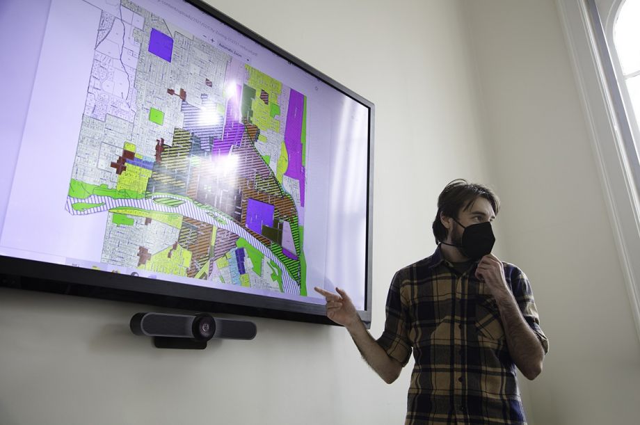
Demystifying the current patchwork of codes across the country would have felt impossible just a few years back — but not anymore, thanks to the May launch of the National Zoning Atlas. This ambitious initiative, housed at the Legal Constructs Lab at Cornell University, is designed to display zoning codes across the country on an online, user-friendly map, with the goal to strengthen national and local planning for housing production, transportation infrastructure and climate response. The effort was seeded from local advocacy in Connecticut; today, 10 states including New York and California have spearheaded their own efforts.
“There are professors, researchers and advocates all over the country who agree that the lack of zoning data is hindering good research and policymaking,” says Sara Bronin, the professor who kicked off the Connecticut work. “I knew that a tool to standardize information about zoning across jurisdictions, within regions and across state lines, would be really impactful.”
Such a wide-ranging national effort started as a local project for Bronin. Following 2020’s summer protest movement demanding racial justice, Bronin thought about how zoning upheld segregated land use across Connecticut, with one-family lots making up wealthy, white neighborhoods and denser housing concentrated in lower-income urban areas. She founded Desegregate CT to begin a public conversation on that impact and kept running into a basic question: “What’s zoning like in my town?”
That resulted in the Connecticut Zoning Atlas, a first-in-the-nation interactive map showing how all 2,620 zoning districts and two subdivision districts in Connecticut treat housing. This massive undertaking — which required a collaborative team to read, analyze and map 32,378 pages of regulations — resulted in advocacy for a statewide zoning bill as well as increased awareness and momentum around zoning outside the state.
Bronin wanted to document the Connecticut effort so other states could spearhead their own. This was no small feat given the work required: “Building a zoning atlas requires a multi-disciplinary team of collaborators who have patience, are maniacal about detail, and can maintain a sense of humor,” as it says on the National Zoning Atlas website. “That’s because the only way to create a zoning atlas currently is to manually sift through text and maps — a frustrating and repetitive task.”
This January, Bronin and Ilya Ilyankou (at the time a staff member of the CT Data Collaborative, who helped develop the atlas) publicly released How To Make a Zoning Atlas to help others translate and standardize zoning information to create their own regional or statewide atlas; as well as ensure that atlas would compatible with, and could be merged into, a future National Zoning Atlas. The launch of the National Zoning Atlas this May ensures that zoning work spearheaded by local groups has a centralized home.
The expansion to New York began during a seven-week course Bronin taught at Cornell specifically about the creation of an atlas. “The Cornell team was the first attempt at making a structured, intentional group that was starting at the same time and moving forward all together to create an atlas,” explains Adam Bailey, a student of the course who became project manager of the New York Zoning Atlas.
The team requested zoning data from Tompkins County, where Cornell is located, as well as four surrounding counties. “It was surprisingly hard to get zoning codes from some towns,” Bailey says — a challenge also faced in Connecticut. In some cases, students had to track down local town planners to request zoning maps. The students successfully recorded data for all five counties.
A group from the University of Buffalo School of Law is mapping Erie County, while a team from the Fordham Law School Urban Law Center has started mapping New York City. Their work will soon become the online New York Zoning Atlas.
Regional Plan Association (RPA) and the Community Development Corporation of Long Island are spearheading mapping in Long Island, New York, where zoning for single-family housing has long upheld segregation. “There was a lot of interest in replicating the model because we saw a lot of similarities, and challenges, on Long Island as we did in Connecticut,” says Melissa Kaplan-Macey, RPA’s vice president for state programs and its Connecticut Director.
As opposed to being based at a college, RPA and the Community Development Corporation of Long Island are spearheading the zoning data collection that will be used as the basis for a Long Island Zoning Atlas mapping. The first phase, the data collection effort, will kick off this summer.
Kaplan-Macey hopes a Long Island Atlas will result in similar organizing that’s taken off in Connecticut to demystify zoning and center it as a community concern. Desegratege CT shares videos of personal stories related to zoning, for example, and mobilized significant support for Senate Bill 1024, a zoning reform bill that passed last year. (Desegregate CT is now advocating for legislation around transit-oriented development.)
Crucially, Kaplan-Macey says, the efforts of Desegregate CT and the Connecticut Zoning Atlas resulted in a strong, well-coordinated response during both the 2021 and 2022 legislative sessions as zoning reform bills faced resistance, pushback and even conspiracy theories.
“We’re aligning on the message and strategizing on getting it out there in an impactful way,” she says. Zoning reform faces similar pushback in New York, especially from Long Island. “Part of the impetus for this work is that without the data we had underpinning the advocacy work in Connecticut, it’s an even bigger challenge to overcome the political pressure.”
State and regional groups are invited to join the National Zoning Atlas Research Collaborative for further support and connections to funders. Through this network, Bronin connected the Center for Ethics in Society at Saint Anselm College in New Hampshire to additional funding that supports the development of the New Hampshire Zoning Atlas.
The New Hampshire team consists of students studying urban policy as well as politics, drama, philosophy and English literature. To professor Max Latona, who oversees the group, it signals how widespread the concerns of affordable housing and segregation have become — especially to the younger generation. “The common thread in interviewing these students was that they were passionate about the equity issue,” he says. The team expects to map all 270 jurisdictions of New Hampshire by the end of this year.
The more the National Atlas is filled, Bronin hopes, the clearer the narrative becomes about achieving truly equitable, progressive zoning. “We’ll need to fill out the national map in order to see whether advocates use it to justify reforms beyond the state-by-state level,” she says.
“As we do that,” she continues, “Each state will have a story to tell when it comes to zoning … and I think the story will be pretty consistent to what we’ve found in Connecticut, which is that so much of our zoning restricts the kind of diverse housing that people want.”

Emily Nonko is a social justice and solutions-oriented reporter based in Brooklyn, New York. She covers a range of topics for Next City, including arts and culture, housing, movement building and transit.
Follow Emily .(JavaScript must be enabled to view this email address)


_(1)_600_350_s_c1.png)

